Kennon Road in Google Earth
Jun 10 2006 Sat
11:42 am PHT
When I found out that Metro Manila, among other Philippine cities, have hi-res satellite imagery in Google Earth, I lamented the fact that I still don’t have broadband access since Google Earth works much much better on when you have fat data pipes. (See this thread over at SkyscaperCity (old dead link) for a whole bunch of Google Earth screenshots.)
But I couldn’t wait to have broadband, so I just downloaded Google Earth last night and hoped that it will be bearable under dial-up. Hehehe. And you know what? Google Earth is the coolest 3D application I’ve tried since Celestia! Under dial-up, images take a while to download, but it’s worth the wait!
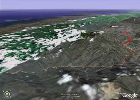
The terrain data layer is especially great. See this screenshot I took of Google Earth below, highlighting Kennon Road going to Baguio City. (The image is also a link to a larger version.) Seeing the Kennon Road terrain is one thing I have been wanting to visualize for several years now. And now I have!

Comments
[an error occurred while processing this directive]